Geospatial Analysis
Geo analysis and geoinformation plays a vital part in decision-making in both project development and project realization.
UnEx provides the following services:
Geo analysis and geoinformation plays a vital part in decision-making in both project development and project realization.
UnEx provides the following services:
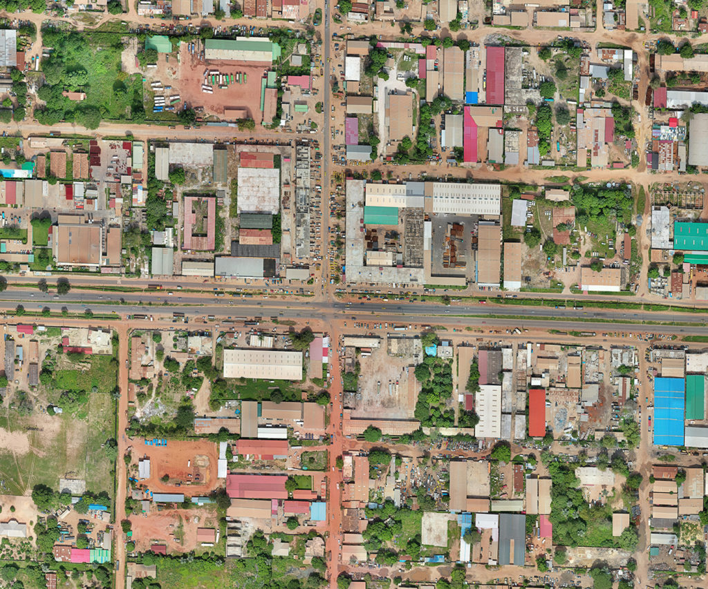
Geometrically corrected images that are commonly used for:
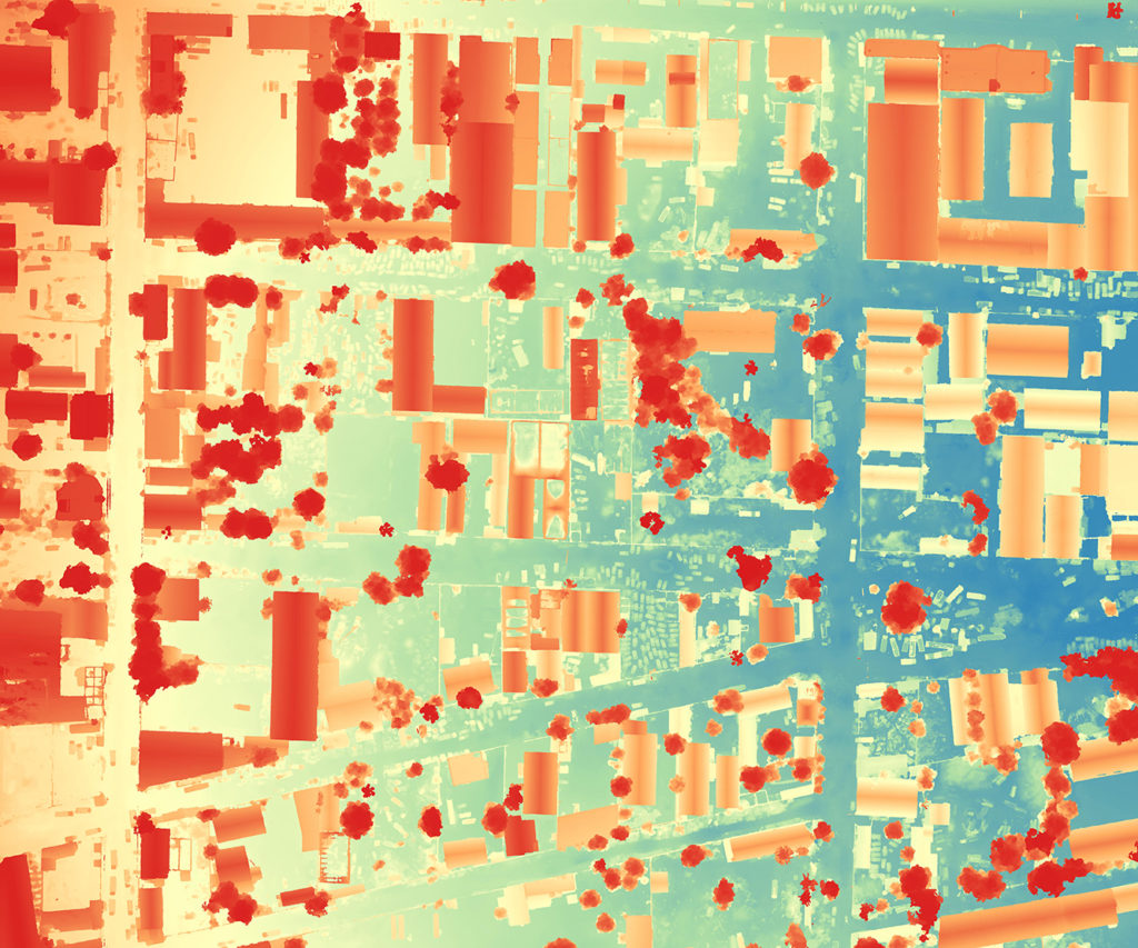
Digital depiction of the earth surface. This includes the elevation of the terrain and objects like trees and buildings. DSM can be used:

Data collection and analysis helps project developers from different sectors to scan the area of development and plan the project more efficiently.
For example, in the energy industry, UnEx can determine the rooftop area, slope and suitable location for mounting rooftop PVs in both rural and urban regions and even provide different scenarios.

UnEx provide its expertise to urban planners so they can benefit from a general overview in planning of an urban area at every step of the process and have constantly updated geospatial data at hand.
It is a visioning planning tool for future infrastructure projects that implements middle and long-term solutions

At UnEx, an addressing system has been designed that enhances many urban services such as mail delivery, billing of electricity, tax collection, or taxi, fire fighter, ambulance and police services. This system also helps with safety and security.
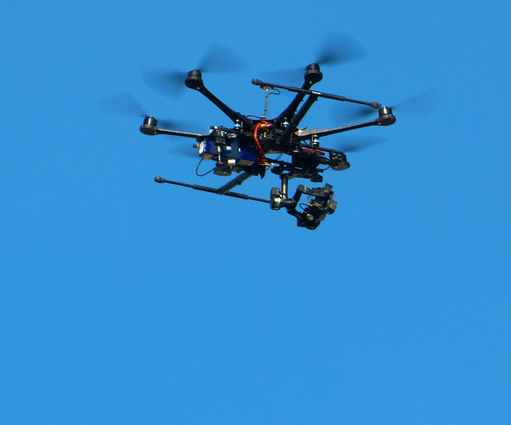
At United Experts, drones are used for survey and inspection of land plots which creates a more precise result while achieving time efficiency.
For example, a conventional survey takes double the time in comparison with drone survey.
Aerial survey and inspection enables:

| Cookie | Duration | Description |
|---|---|---|
| cookielawinfo-checkbox-analytics | 11 months | This cookie is set by GDPR Cookie Consent plugin. The cookie is used to store the user consent for the cookies in the category "Analytics". |
| cookielawinfo-checkbox-functional | 11 months | The cookie is set by GDPR cookie consent to record the user consent for the cookies in the category "Functional". |
| cookielawinfo-checkbox-necessary | 11 months | This cookie is set by GDPR Cookie Consent plugin. The cookies is used to store the user consent for the cookies in the category "Necessary". |
| cookielawinfo-checkbox-others | 11 months | This cookie is set by GDPR Cookie Consent plugin. The cookie is used to store the user consent for the cookies in the category "Other. |
| cookielawinfo-checkbox-performance | 11 months | This cookie is set by GDPR Cookie Consent plugin. The cookie is used to store the user consent for the cookies in the category "Performance". |
| viewed_cookie_policy | 11 months | The cookie is set by the GDPR Cookie Consent plugin and is used to store whether or not user has consented to the use of cookies. It does not store any personal data. |